Just outside the city of Toliara, cut by the Tropic of Capricorn in southern Madagascar, the biggest community of African lutheran exorcists was founded: a whole village where all the citizens are exorcists, often both husbands and wives, and their little children attending the school for young exorcists, where many candidates are training how to fight the devil.
Considered by the westerners as a mere past chapter of their History, Plague is an ancient flea-borne disease with a case fatality rate of 50-60% if left untreated. Nowadays, plague still represents a public health concern in affected countries in Africa, Asia and Americas.
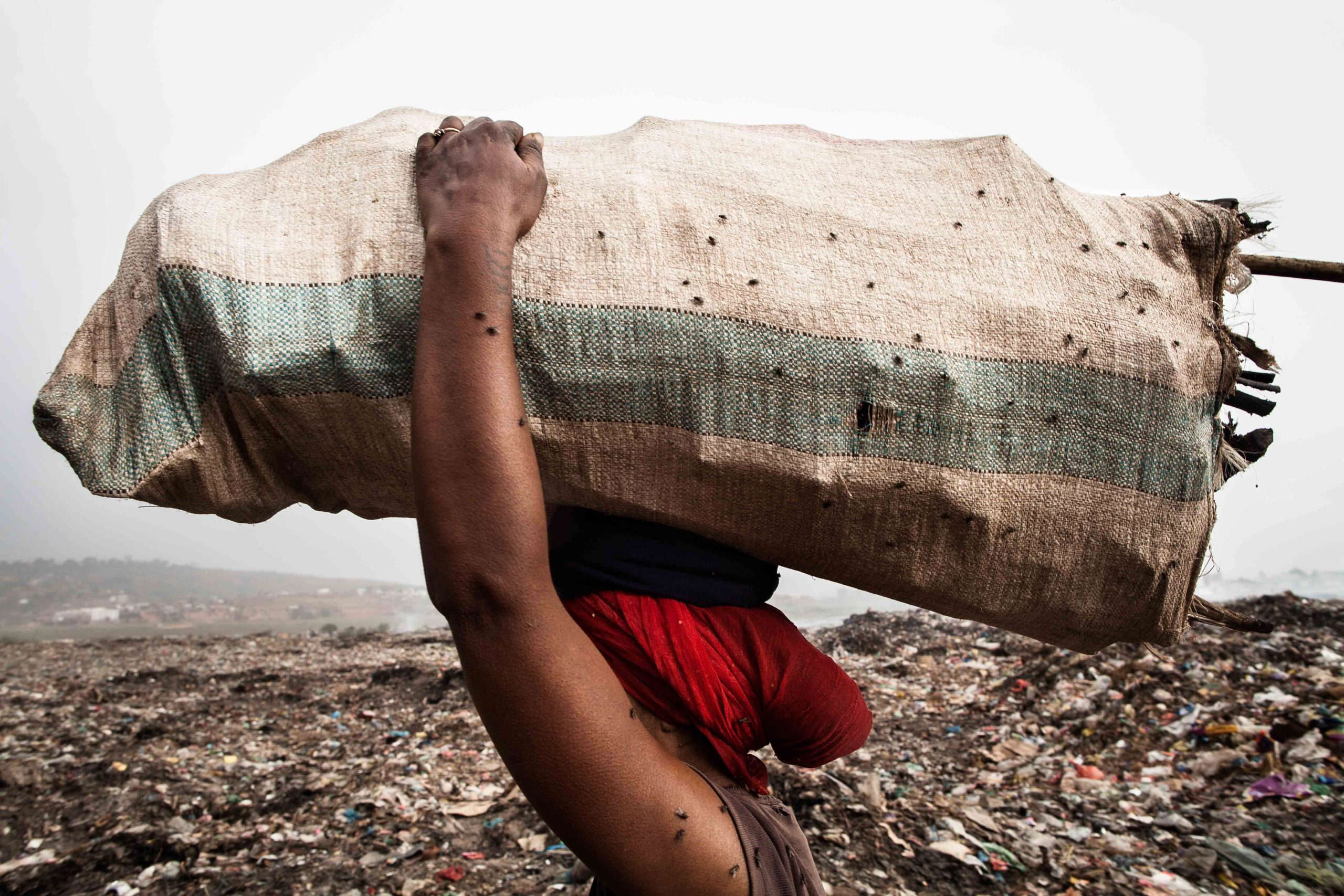
Antananarivo, capital of Madagascar, is home to one of the largest dumpsites of the African continent, operative since the ‘60s. The dumpsite, which now covers over 45 acres and is still expanding, receives between 350 and 550 tons of new waste each day.
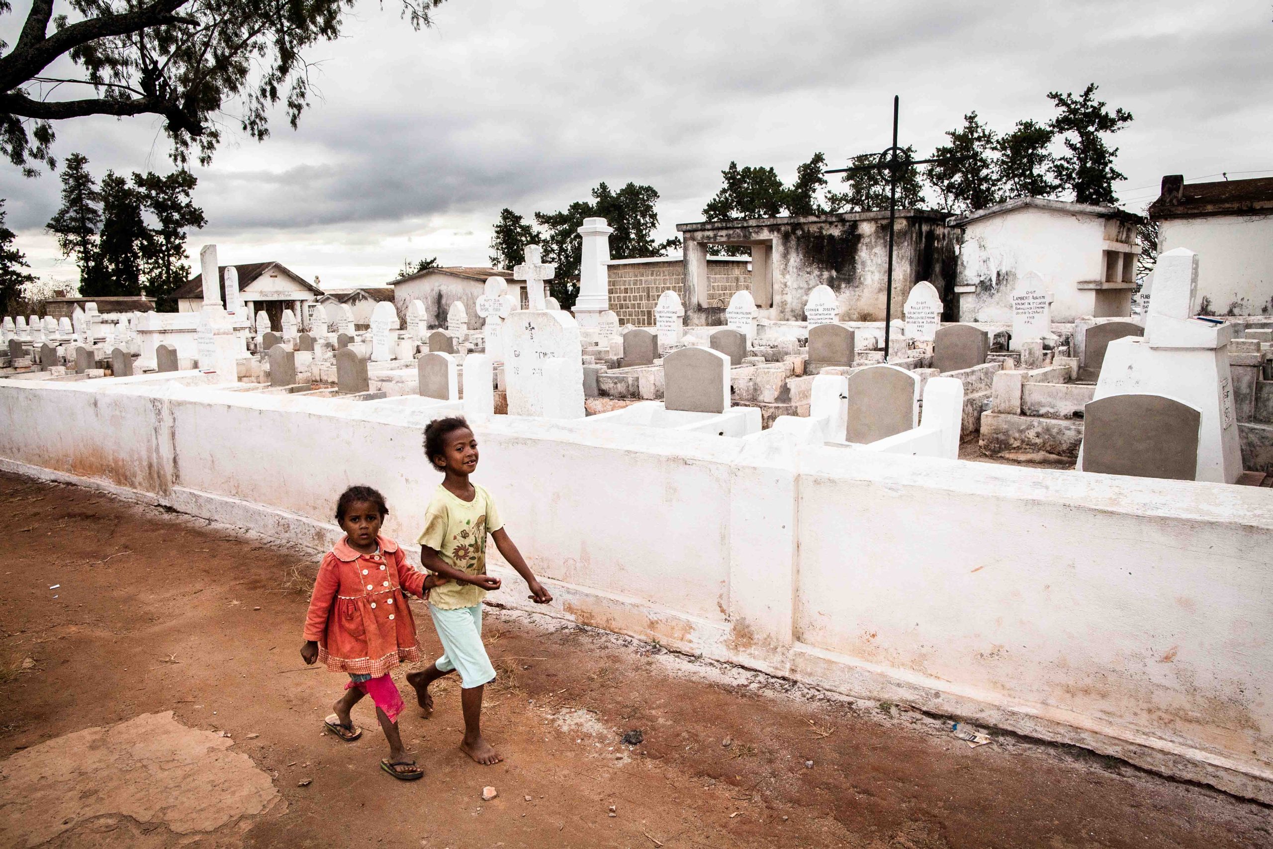
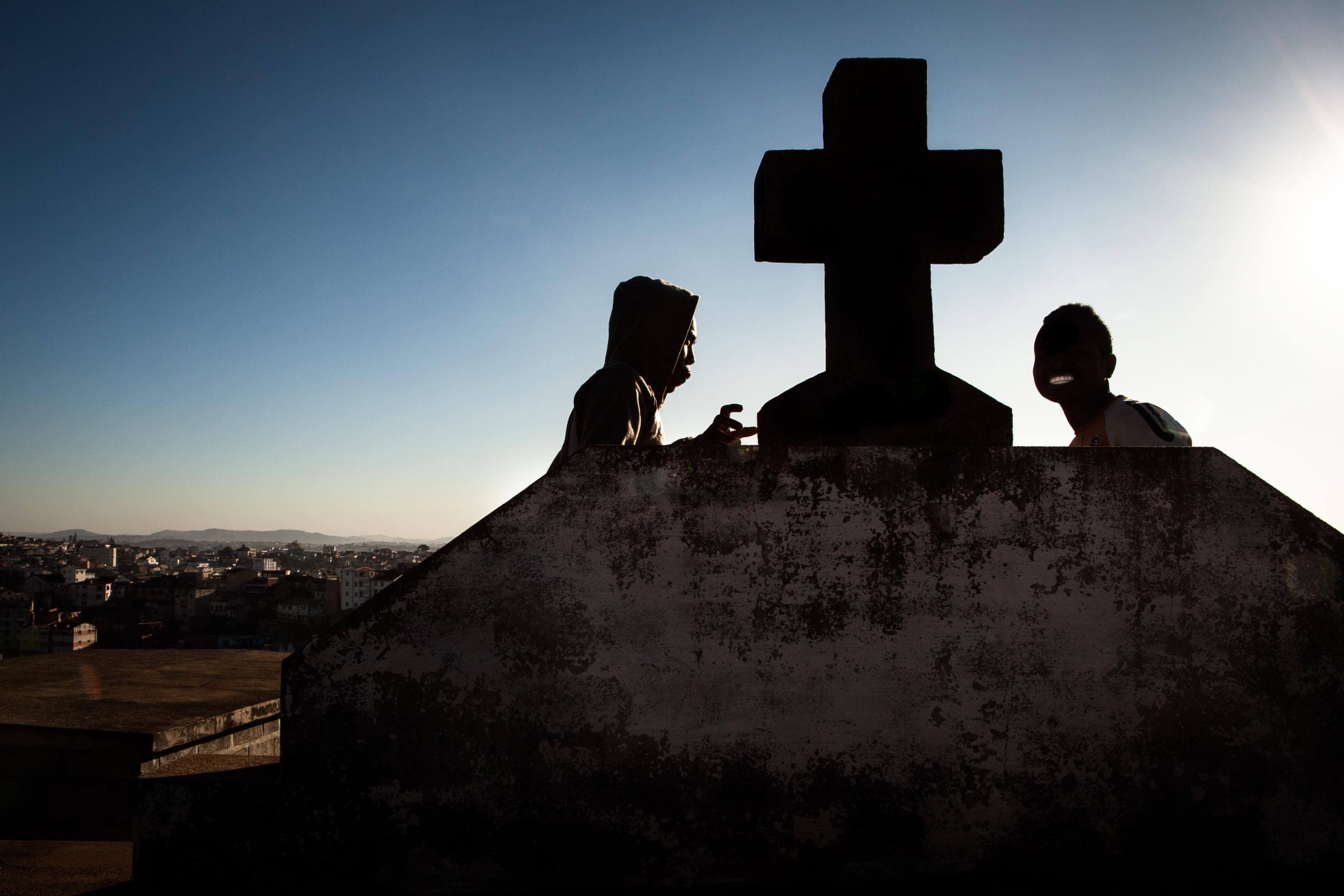
Anjanahary Cemetery is one of the only and by far the biggest graveyard in Madagascar. Classified by the government as a Red Code Area for what concerns security, it is considered to be one of the most dangerous place in Antananativo, whose intricate maze of graves and crypts became a perfect sanctuary for fugitives, thieves, fences, drug dealers and drugs addicted trying to elude the police.
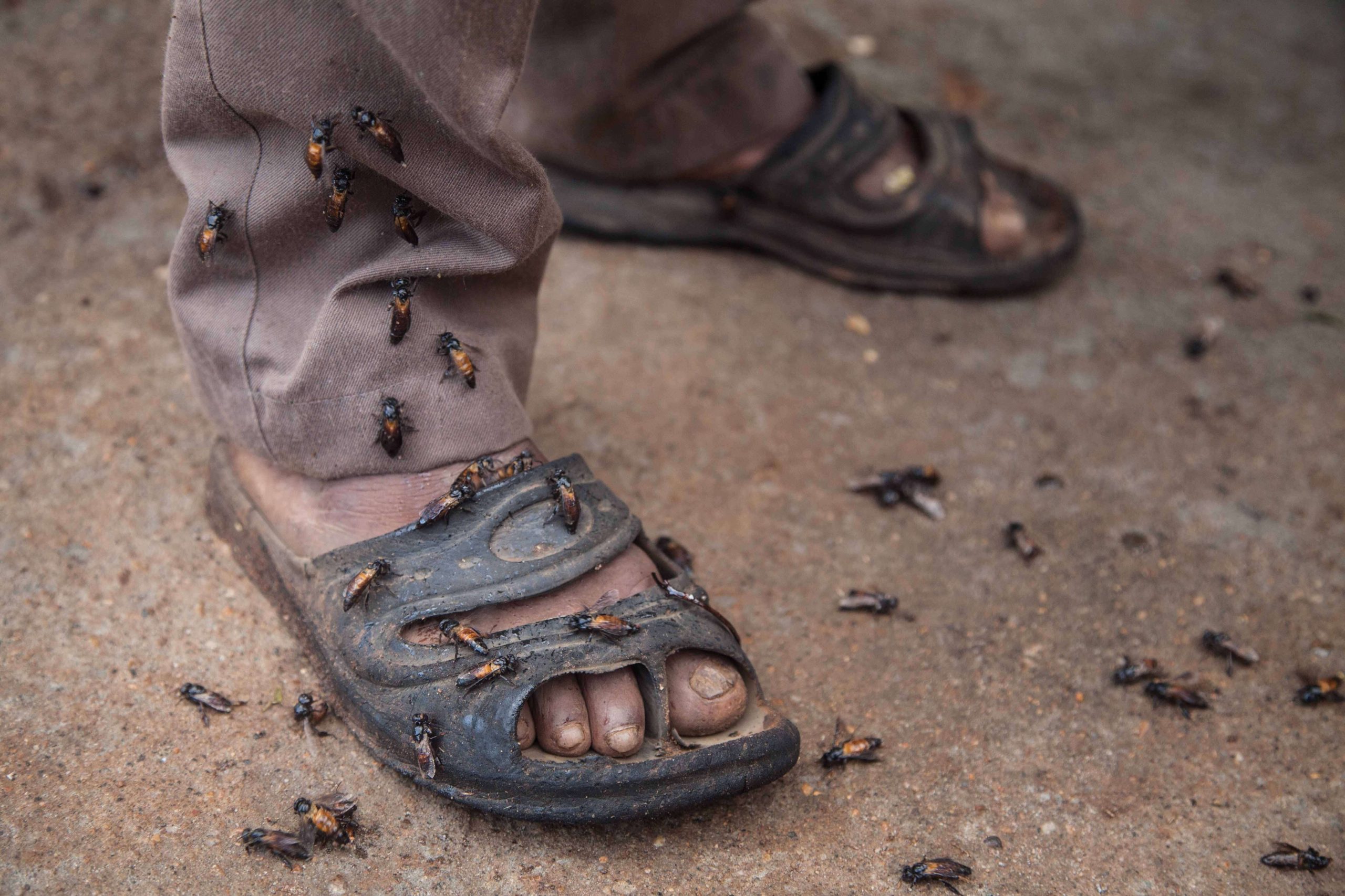
Apis Dorsata, also called the giant rock bee, is the biggest social bee known today. Their nests are mainly built in exposed place far off the ground, on tree limbs or under cliff overhangs. In the Nilgiri’s Blue mountains, where Irula and Kurumba tribes live, these bees produce a very rare bitter honey.

Bolivia is proud of being the Latin American country with the highest number of actively working women. Bolivian women no longer are the subject for the “weaker sex” prejudice, they are rather associated with the outstanding physical stamina, the inclination to struggle and the great brute strength.